Watch a dramatic video of probable MH370 seabed location
01 December, 2021
3 min read

By joining our newsletter, you agree to our Privacy Policy
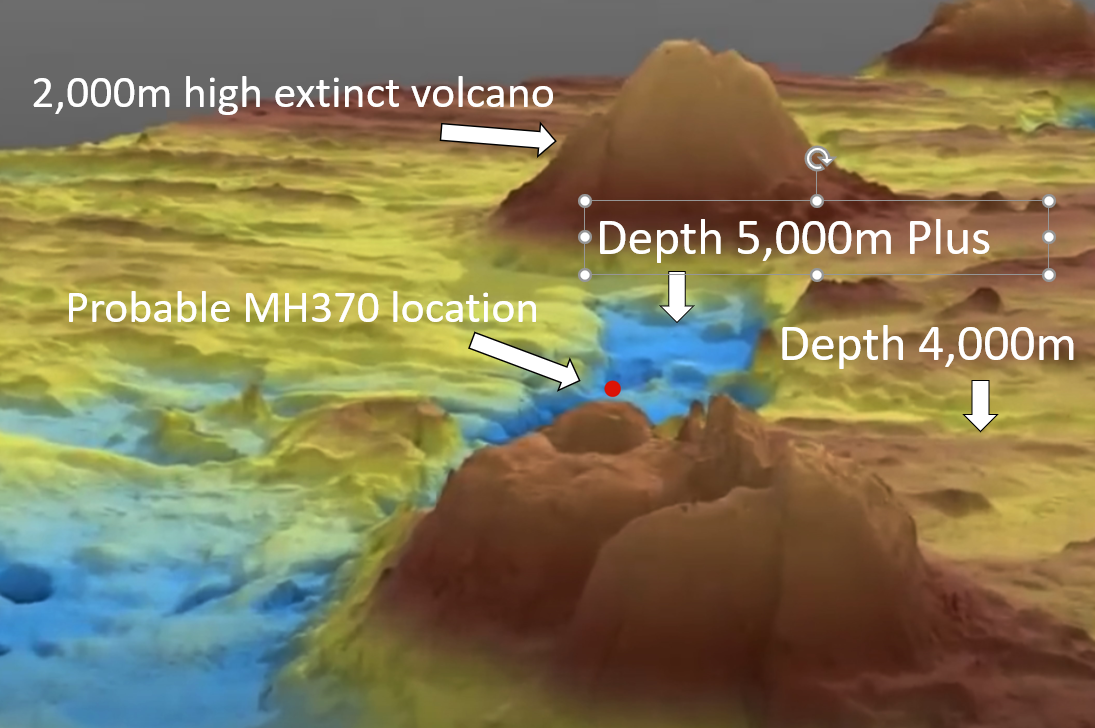
We have obtained a dramatic video of the seabed where British aerospace engineer Richard Godfrey says MH370 lies.
The video was part of the material made available by the Australian Transport Safety Bureau investigation of the loss of MH370 and was created by GeoScience Australia.
https://youtu.be/ONxMJruYHyY
This particular area was searched by Fugro under contract to the ATSB and some anomalies were detected but another search of these anomalies by a Chinese vessel apparently did not find anything of interest.
Mr. Godfrey is using new tracking technology to identify a far more precise crash position for MH370 in the southern Indian Ocean.
According to Mr. Godfrey MH370 impacted the ocean 1,933 km due west of Perth at 33.177°S 95.300°E and lies at a depth of 4,000m in a very mountainous area with deep ravines and a volcano as can be seen from the video clip.
The location is in the zone where the University of WA Head of Oceanography Professor Charitha Pattiaratchi claims MH370 is located.
The revelation is expected to provide the impetus for a new search later next year.
READ: WSPRnet explain
READ: MH370: The extraordinary debris trail across the Indian Ocean
READ: MH370: chronology of major events
READ: Qatar Airways award-winning Qsuites the ultimate in privacy
Malaysia Airlines Flight MH370 vanished during a flight from Kuala Lumpur to Beijing on March 8, 2014, before plunging into the southern Indian Ocean — taking 239 passengers and crew.
The new technology is called WSPR and Mr. Godfrey likens it to “a bunch of tripwires or laser beams, but they work in every direction over the horizon to the other side of the globe.”
Put simply, as the aircraft flies through the “tripwire” the disturbance is recorded in a database.
Mr. Godfrey has spent the last nine months using his revolutionary technology on a series of “blind” flights that were not recorded on the usual tracking systems.
In each case, he was able to track the flight accurately in trials adjudicated by AirlineRatings.com and a former Qantas 747 captain.
“My WSPRnet based flight path matches all the Inmarsat data,” Mr. Godfrey said.
MH370 was interrogated every hour by an Inmarsat satellite over the Indian Ocean and the communication was relayed via a receiving station in Gnangara to the UK.

Next Article
3 min read
Virgin gets nod for Tiger deal

Get the latest news and updates straight to your inbox
No spam, no hassle, no fuss, just airline news direct to you.
By joining our newsletter, you agree to our Privacy Policy
Find us on social media
Comments
No comments yet, be the first to write one.