Startling new clues have been revealed from the new tracking of MH370 by aerospace engineer Richard Godfrey using the new breakthrough tracking technology called Weak Signal Propagation (WSPR).
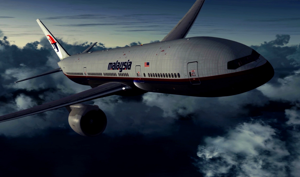
MH370 disappeared on a flight from Kuala Lumpur to Beijing on March 8, 2014, taking 239 souls.
READ: Qatar Airways adds more flights to Australia
READ: WSPRnet explained
Mr. Godfrey's retracing of the flight path of MH370 which is due to be completed early in December has revealed that the pilot in command (PIC) of the Boeing 777 made many turns to avoid detection before it settled on its fatal course into the Southern Indian Ocean.
But even then the flight path zigzagged.
For instance, in May this year, Mr. Godfrey said that “The PIC appears to have had knowledge of the operating hours of Sabang and Lhokseumawe radar and that on a weekend night, in times of little international tension the radar systems would not be up and running.”
Mr. Godfrey found that “in case the aircraft was detected, the pilot also avoided giving a clear idea where he was heading by using a fight path with a number of changes of direction. These changes of track included toward the Andaman Islands, towards South Africa, towards Java, towards 2°S 92°E (where the Flight Information Regions of Jakarta, Colombo, and Melbourne meet) and towards Cocos Islands.”
After the May revelations, Mr. Godfrey set about a series of blind tests to refine the technology.
These blinds tests were set up by an ex-Qantas Captain Mike Glynn and adjudicated by AirlineRatings.com
Mr. Godfrey resumed his tracking of MH370 in September and then revealed in a sensational development that after following the coastline of Sumatra the Boeing 777 was put into a holding pattern for 22 minutes before proceeding south.
“What I found out, without looking for it, was that MH370 entered a race track holding pattern at around 19:12 UTC:
“I was surprised to discover that not only did MH370 enter a holding pattern but that the holding pattern lasted for around 22 minutes until 19:34 UTC.
Below is a map of the early part of the MH370 flight path showing the holding pattern.
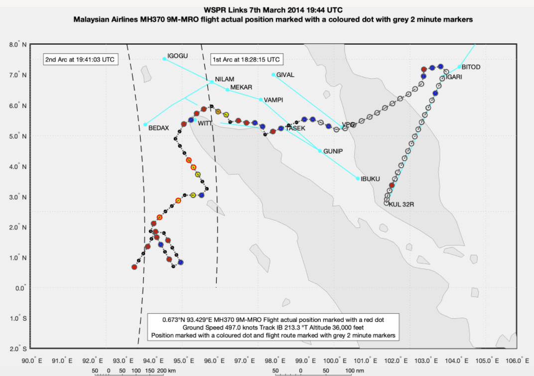 “The Inmarsat satellite BTO and BFO data matches perfectly the timing, position, and track at the 1st Arc (18:28 UTC BTO and BFO), during the SATCOM call (18:40 UTC, BFO only) and the 2nd Arc (19:41 UTC BTO and BFO). On entering the holding pattern MH370 was 150 nm from the coast of Sumatra and 40 nm from the 2nd Arc,” Mr Godfrey said.
"The burning question is why did Captain Zaharie Shah or the person in control of MH370 allegedly put the 777 into a holding pattern?"
Mr. Godfrey continues;
“If the pilot’s goal was to make MH370 disappear without a trace, then why waste fuel with a holding pattern and why not head directly to the most remote area possible of the Indian Ocean without deviation, asked Mr. Godfrey on November 9, 2021.
Then on November 18, Mr. Godfrey revealed that the pilot put the Boeing 777 into a zigzag flight path as he flew south as per this new map below which also shows the arc intercepts of the Inmarsat Satellite tracking every hour. This map illustrates the tracking of MH370 so far and Mr. Godfrey is due to complete his research in early December.
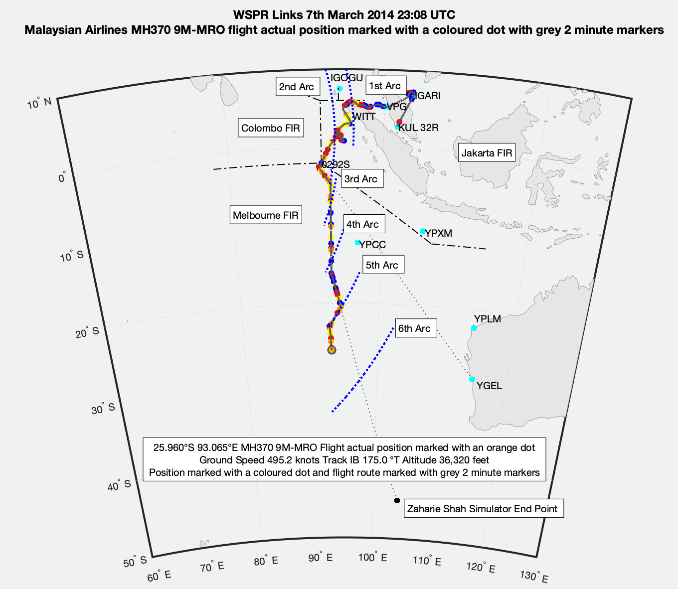 In the November 18 update, Mr. Godfrey said the MH370 flight path was due south from 20:32 UTC until 21:54 UTC.
“The speed was aligned initially to the Long-Range Cruise (LRC), then later to the Maximum Range Cruise (MRC) autothrottle speed schedule and then even later back to LRC,” Mr Godfrey said.
“Then at 21:54 UTC MH370 turned South East on to track 163.3 °”
“At the same time, MH370 accelerated to the maximum cruise speed at FL360 at Mach 0.866 and a Ground Speed of 505.8 knots.”
“This is again evidence of an active pilot,” Mr. Godfrey said.
“A continuation along this track with an initial bearing of 163.3 °T would lead you eventually very close to the Zaharie Shah Home Flight Simulator end point of 45.0852°S 104.1455°E.”
“At 22:26 UTC MH370 turned South West again on to a track of 213.8°T.”
“By pure coincidence, the 777 tracks South West parallel to the 5th Arc with a small offset and the position of the 777 at 22:41:22 UTC exactly matches the Inmarsat Satellite BTO and BFO data,” Mr. Godfrey said.
 “The Inmarsat satellite BTO and BFO data matches perfectly the timing, position, and track at the 1st Arc (18:28 UTC BTO and BFO), during the SATCOM call (18:40 UTC, BFO only) and the 2nd Arc (19:41 UTC BTO and BFO). On entering the holding pattern MH370 was 150 nm from the coast of Sumatra and 40 nm from the 2nd Arc,” Mr Godfrey said.
"The burning question is why did Captain Zaharie Shah or the person in control of MH370 allegedly put the 777 into a holding pattern?"
Mr. Godfrey continues;
“If the pilot’s goal was to make MH370 disappear without a trace, then why waste fuel with a holding pattern and why not head directly to the most remote area possible of the Indian Ocean without deviation, asked Mr. Godfrey on November 9, 2021.
Then on November 18, Mr. Godfrey revealed that the pilot put the Boeing 777 into a zigzag flight path as he flew south as per this new map below which also shows the arc intercepts of the Inmarsat Satellite tracking every hour. This map illustrates the tracking of MH370 so far and Mr. Godfrey is due to complete his research in early December.
 In the November 18 update, Mr. Godfrey said the MH370 flight path was due south from 20:32 UTC until 21:54 UTC.
“The speed was aligned initially to the Long-Range Cruise (LRC), then later to the Maximum Range Cruise (MRC) autothrottle speed schedule and then even later back to LRC,” Mr Godfrey said.
“Then at 21:54 UTC MH370 turned South East on to track 163.3 °”
“At the same time, MH370 accelerated to the maximum cruise speed at FL360 at Mach 0.866 and a Ground Speed of 505.8 knots.”
“This is again evidence of an active pilot,” Mr. Godfrey said.
“A continuation along this track with an initial bearing of 163.3 °T would lead you eventually very close to the Zaharie Shah Home Flight Simulator end point of 45.0852°S 104.1455°E.”
“At 22:26 UTC MH370 turned South West again on to a track of 213.8°T.”
“By pure coincidence, the 777 tracks South West parallel to the 5th Arc with a small offset and the position of the 777 at 22:41:22 UTC exactly matches the Inmarsat Satellite BTO and BFO data,” Mr. Godfrey said.
Have questions or want to share your thoughts?

.jpg)
