By joining our newsletter, you agree to our Privacy Policy
Share this story
Steve Creedy
31 January, 2018
The Malaysian Government has confirmed the area identified by CSIRO scientists as the most likely site for the missing Malaysia Airlines flight MH370 has been swept without identifying the wreckage.
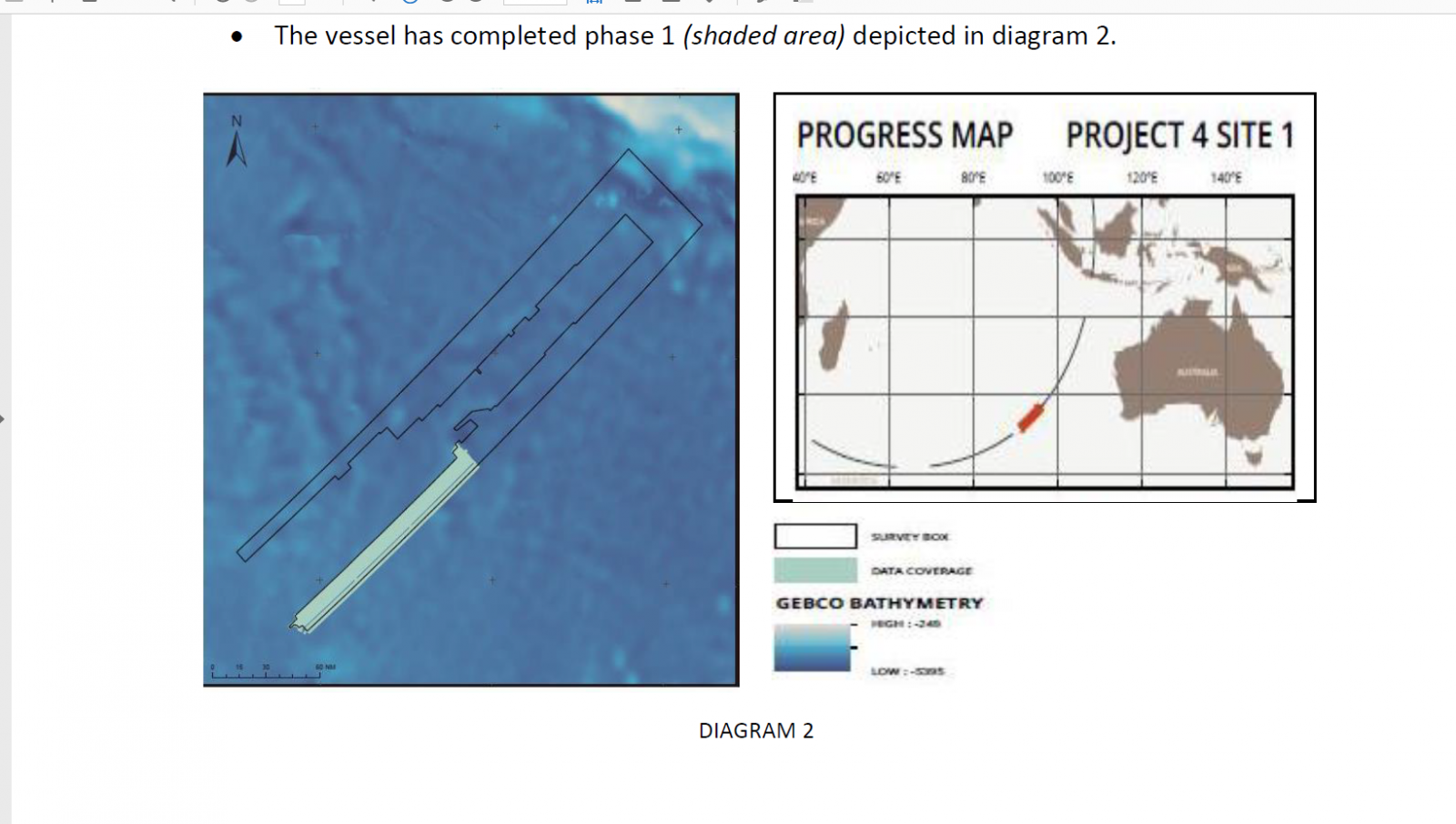
The MH370 response team issued a statement saying that as of January 28, the search had covered 4500 sq. kms to the east of the seventh arc defined by the final satellite handshake.
This area contained the position at latitude 35.6° S and longitude 92.8° E described by the CSIRO as the most likely location of the aircraft.
“No significant contacts identified to date,’’ the update said.
However, an independent expert following the search by satellite said Wednesday the Seabed Constructor had moved back into the eastern search area and appeared to be rescanning one of the tracks previously covered by a Hugin autonomous underwater vehicle.
The area searched by January 28. Source. MH370 Response Team.
"The ship's speed has been variable, suggesting that the AUV has not been using its side scan sonar continuously, since it is understood that requires a particular speed, around 3 knots,'' Richard Cole said in a January 31 update.
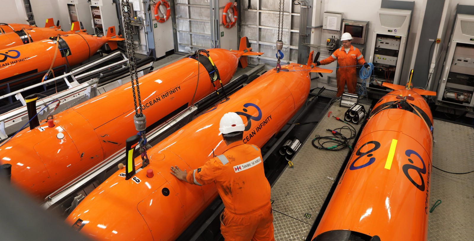
The move comes after Seabed Constructor, the high-tech ship employed to search for flight MH370, swept the western side of arc containing two other points also identified in CSIRO drift studies as possibilities but thought to be less likely options than the first location.
The vessel is accompanied by a support ship, the MV Maersk Mariner, which joined it from the West Australian port of Fremantle.
Independent experts monitoring the operation via satellite said the Seabed Constructor had conducted three sweeps by January 31 using its fleet of Hugin autonomous underwater vehicles.
They believe the ship used eight AUVs in the first two sorties to the east of the arc and seven to search the smaller area to the west.
The company behind the search, Ocean Infinity, has a “no find, no fee” deal with the Malaysian government.
This sees it paid $US20 million if the debris is found in the 5000 sq. km primary search area, $US30m in the 10,000 sq, km secondary zone and $US50m in the 10,000 sq, km tertiary area.
The three zones make up a 25,000 sq.m area defined in the Australian Transport Safety Bureau’s final report as most likely to contain the debris after a search of the original 120,000 sq km search zone failed to find it
OI will get $US70m if it locates the wreckage in outside that 25,000 sq, km zone and a number of experts have suggested this is where it is.
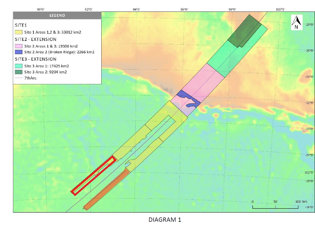
The University of Western Australia's Professor Charitha Pattiaratchi said last year that its rift modeling put the location of MH370 “at Longitude 96.5° E Latitude 32.5° S with a 40km radius.”
Some members of the Independent Group believe it may be even further north and a map on the Malaysian update identifies two "site extensions", one of which ranges north of 29° S.
The map showing site extensions. Source: MH370 Response team
The update said favourable weather condition are forecast for the week ahead. The Seabed Constructor is due to berth in Fremantle next week
The Malaysian Government has confirmed the area identified by CSIRO scientists as the most likely site for the missing Malaysia Airlines flight MH370 has been swept without identifying the wreckage.
The MH370 response team issued a statement saying that as of January 28, the search had covered 4500 sq. kms to the east of the seventh arc defined by the final satellite handshake.
This area contained the position at latitude 35.6° S and longitude 92.8° E described by the CSIRO as the most likely location of the aircraft.
“No significant contacts identified to date,’’ the update said.
However, an independent expert following the search by satellite said Wednesday the Seabed Constructor had moved back into the eastern search area and appeared to be rescanning one of the tracks previously covered by a Hugin autonomous underwater vehicle.
The area searched by January 28. Source. MH370 Response Team.
"The ship's speed has been variable, suggesting that the AUV has not been using its side scan sonar continuously, since it is understood that requires a particular speed, around 3 knots,'' Richard Cole said in a January 31 update.
The move comes after Seabed Constructor, the high-tech ship employed to search for flight MH370, swept the western side of arc containing two other points also identified in CSIRO drift studies as possibilities but thought to be less likely options than the first location.
The vessel is accompanied by a support ship, the MV Maersk Mariner, which joined it from the West Australian port of Fremantle.
Independent experts monitoring the operation via satellite said the Seabed Constructor had conducted three sweeps by January 31 using its fleet of Hugin autonomous underwater vehicles.
They believe the ship used eight AUVs in the first two sorties to the east of the arc and seven to search the smaller area to the west.
The company behind the search, Ocean Infinity, has a “no find, no fee” deal with the Malaysian government.
This sees it paid $US20 million if the debris is found in the 5000 sq. km primary search area, $US30m in the 10,000 sq, km secondary zone and $US50m in the 10,000 sq, km tertiary area.
The three zones make up a 25,000 sq.m area defined in the Australian Transport Safety Bureau’s final report as most likely to contain the debris after a search of the original 120,000 sq km search zone failed to find it
OI will get $US70m if it locates the wreckage in outside that 25,000 sq, km zone and a number of experts have suggested this is where it is.
The University of Western Australia's Professor Charitha Pattiaratchi said last year that its rift modeling put the location of MH370 “at Longitude 96.5° E Latitude 32.5° S with a 40km radius.”
Some members of the Independent Group believe it may be even further north and a map on the Malaysian update identifies two "site extensions", one of which ranges north of 29° S.
The map showing site extensions. Source: MH370 Response team
The update said favourable weather condition are forecast for the week ahead. The Seabed Constructor is due to berth in Fremantle next week