MH370 searchers may know within a week whether plane is at CSIRO hotspot

By Steve Creedy Mon Jan 22, 2018
The company searching for Malaysia Airlines Flight MH370 could know within a week whether the plane is in a spot considered the most likely crash site by CSIRO scientists.
The search restarted in earnest after the Seabed Constructor reached the 25,000 sq km identified by the Australian Transport safety Bureau and other experts as most likely to contain the debris.
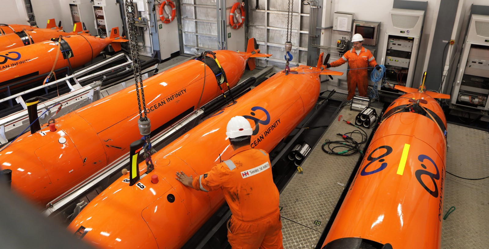
The high-tech mothership is expected to deploy up to eight Hugin autonomous underwater vehicles almost immediately in the south-eastern extremity of the area of the zone and near a position at latitude 35.6°S and longitude 92.8°E described by the CSIRO as the most likely location of the aircraft.
A team headed by CSIRO scientist Dr David Griffin used drift modeling and an analysis of satellite imagery to define the site.
Read: MH370 debris hunter says news search will find it.
They said other nearby locations east off the 7th arc were also possible and there were a range of less likely locations on the western side of the arc, near 34.7°S 92.6°E and 35.3°S 91.8°E.
US firm Ocean Infinity has been contracted by the Malaysian Government to search for the wreckage on a “no find, no fee” basis that could see it take home between $US20 million and $US70 million if the wreckage is found.
OPINION: Australia's crash investigator among the world's best.
Given Ocean Infinity's estimate it can scour 1200 sq. kms of ocean floor a day, the group of independent experts estimates the 25,000 sq. km area could be scanned within 21 days and the highest priority 5000 sq, kms within a week.
This includes the CSIRO’s preferred spot, which is about 66 nautical miles (122kms) from where the ship stopped Sunday.
However, they note it could be Wednesday or Thursday before any results emerge, given data from the AUVs are stored on hard drives that can only be downloaded after they are recovered and dives can last more than two days.
Time is also needed to analyse the data.
In a blog posted Sunday, independent group member Victor Iannello argued it was impossible to determine any one location with a high level of certainty.
“The satellite data and the drift models allow a broad range of possible impact sites. Within that range, there are at best some “warm spots” that are based on assumptions about navigation inputs,’’ he said.
“So, it becomes a numbers game — the more area searched, the higher probability of finding the wreckage.
“I subjectively believe there is a 33 per cent chance of finding the wreckage in the first 25,000 square kilometers.
“ If there is time and money to search at +/- 25 NM from the 7th arc all the way to a latitude of 26S, I subjectively put the chances of success at around 67 per cent.
“That might seem like bad odds, but realistically, that’s higher than they’ve ever been.”
As well as the torpedo-shaped Hugins, the Seabed Constructor is equipped with two remotely operated vehicles that could be used to retrieve debris if it finds the plane.
However, what happens once the plane is found is a decision that will have to be made by the Malaysian Government.
If the Boeing 777 is not found in the 25,000 sq. km area, Seabed Constructor will move north along the 7th arc to other possible areas identified by the international Independent Group and the University of Western Australia.
All of the groups agree on the general area for MH370’s resting place but not on where it might be along the arc.
The UWA and IG predicted the landfall of most debris from MH370 well over three years ago. UWA has identified a location just further north.
UWA’s Professor Charitha Pattiaratchi, said last year that its drift modeling put the location of MH370 “at Longitude 96.5 E Latitude 32.5 S with a 40km radius.”
That location is just south of a major fault line called Diamantina Escarpment – due west of Perth.
Have questions or want to share your thoughts?