The Malaysian government, under intense pressure from relatives of MH370 passengers, has released the Inmarsat satellite data that forms the basis of the current search area for the Boeing 777 off Western Australia.
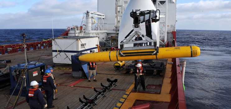
And eighty days after it disappeared the first phase of the tedious search for MH370 and its 239 passengers and crew was halted on May 28 with Ocean Shield returning to port after completing a search of the ocean floor within the depth limits of the Bluefin 21 autonomous underwater vehicle.
However work on the second phase is well under way with the Chinese survey ship Zhu Kezhen mapping the ocean floor in the search zone.
This is required ahead of a widening of the search by a commercial contractor using a towed side scan sonar capable of depths of 6000m.
That search is likely to start in two months.
The main area being searched is where the first two black box pings were located on April 5.
However the sea bed drops away from 4500m to 5500m and even deeper further to the north.
Ocean Shield has searched an area of 10km around ping 2 and adjacent areas to a depth of approximately 4700m.
Chinese ship Haixun 01 is supporting the survey operations, which includes a weekly transportation of survey data to Fremantle for further processing by Geoscience Australia.
According to the Australian Transport safety Bureau the Australian Defence Force’s Military Coordination and Sub-Surface Planning team, in consultation with the Australian Transport Safety Bureau, will partner with Chinese units to conduct the survey.
Work continues to review and analyse all the data and information relating to the likely flight path of MH370, together with the information acquired in the course of the search to date.
The data from communications between satellites and MH370 will enable scientists and analysts around the globe to review the calculation used by the investigators to determine the search area.
It is expected that the data will both spawn and discount theories about what happened MH370.
For some time there was confusion over who could make the satellite data public.
Malaysian officials told CNN earlier this month that their government did not have the raw data.
However Inmarsat officials told CNN the company provided it to Malaysian officials “at an early stage in the search.”
In early May Inmarsat senior vice president Chris McLaughlin insisted that it had “shared the information” it had and said that “it’s for the investigation to decide what and when it puts out.”


