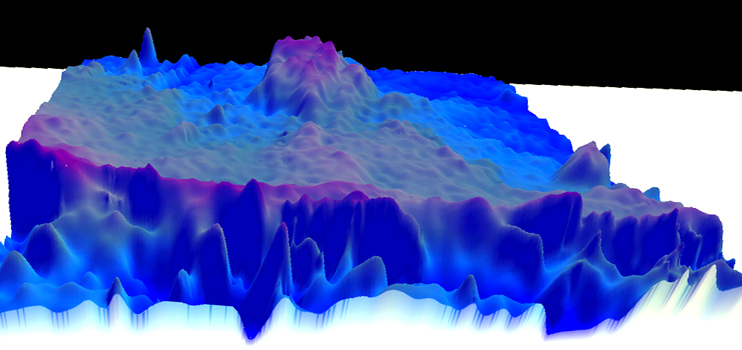
Complex computer analysis of the ocean floor, refinement of Inmarst satellite communications and unanswered phone calls will define the highest priority for the new search for MH370 which disappeared with 239 passengers and crew six months ago.
According to the Australian Transport Safety Bureau (ATSB) Chief, Martin Dolan, the search will resume in just three weeks 1800km west of Perth and is as difficult as you can get. “It’s a hell of an area and horribly complicated.”
Speaking with AirlineRatings.com Mr Dolan said that “the complexities surrounding the search cannot be understated. But it’s not impossible and we remain confident.”
Mr Dolan continued: “There are areas within the highest probability search zone that are of special interest.”
That highest probability search zone covers 60,000km and was determined after detailed analysis by five independent teams.
The ocean floor mapping of this area with echo sounders which started in June is almost complete and has also revealed such features as extinct volcanoes.
Mr Dolan said that Geoscience Australia has been analysing the mapping data obtained by Dutch company Fugro.
This has turned up some “interesting hard objects” but Mr Dolan warned that they could just be rocky formations amongst silty seabed.
The mapping ships have been using multibeam sonar and in addition to providing depth information for underwater navigation, the sonar also provides information about the composition of the sea floor.
The multibeam sonar can identify degrees of hardness, although it cannot distinguish between (for example) the hard metal of an aircraft and the hard rock of the seafloor.
The vast majority of hard spots found are most likely to be geological features as opposed to man-made objects. By identifying these hard objects the ATSB is identifying where closer investigation may be required during the deep water search.
Mr Dolan however puts more emphasis in the analysis of two unanswered phone calls made by Malaysian Airlines to MH370. According to telecommunications data the first phone call made 17 minutes after radar contact was lost north-west of Malaysia indicated the 777 had turned south, a little earlier than originally thought.
This would mean the aircraft would be further south near or beyond Broken Ridge Mr Dolan said.
The search will also be dynamic with ongoing analysis of data throwing up refinements.
The wreckage of MH370 is also likely buried in silt up to 30m deep according to a renowned oceanographer.
Charitha Pattiaratchi, Winthrop Professor of Coastal Oceanography at the University of WA says the search will be “very challenging.”
In a exclusive interview with AirlineRatings.com Professor Pattiaratchi said that the sea bed in the search area varied in depth from 237m to 6220m with deep valleys and soaring mountains.
“There will be a thick layer of marine snow – biological matter – on the sea bed accumulated over millions of years,” said Prof Pattiaratchi.
Three vessels will take part in the search, the Furgo Equator, Furgo Discovery and the Malaysian Go Phoenix.
Each will tow a side-scanner sonar on a 10,000m cable which will feed data live to the ship.
All the scanners have video capability if something of interest is detected. To search the entire area may take 12 months.


