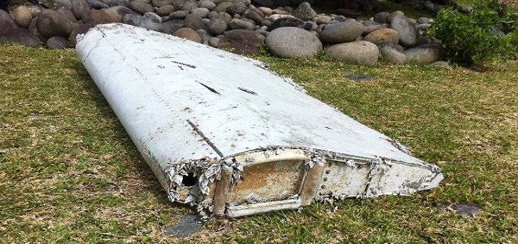
Part of a plane wing, believed to be from a Boeing 777, has washed up on La Reunion Island to the east of Madagascar, sparking speculation that it could be from Malaysia Airlines MH370 which disappeared on March 8, 2014.
The section, thought to be a “flaperon”, is part of the wing that helps control the roll and bank of an aircraft. However it may be from a Yemenia Airbus A310, which crashed off the coast of East Africa in June 2009.
However The Seattle Times is quoting Boeing engineers who have seen pictures of the flaperon and they apparently confirm that it is from a Boeing 777.
A flaperon is a dual-purpose control surface that both extends like a flap during landing and take-off but also moves to roll the aircraft. Interestingly this piece appears to be a composite structure with some delamination and the 777’s flaperons are composite.
Each part of an aircraft has a serial number and Boeing will be able tell if this piece belongs to a 777 and in fact if it is from MH370.
The Australian Transport Safety Bureau has been made aware of the discovery and photos have been sent and are being examined by experts. The ATSB hopes to know more within 24 hours, but that will depend on whether the wreckage has any identifying serial numbers.
Without doubt, the disappearance on March 8th 2014 of MH370, a Boeing 777-200ER with 239 passengers and crew aboard, is the most bizarre in the history of aviation.
Suggested Read, MH370: Human input the only cause
Oceanographers have said that any debris from MH370 would wash up either in Indonesia or the East African coastline.
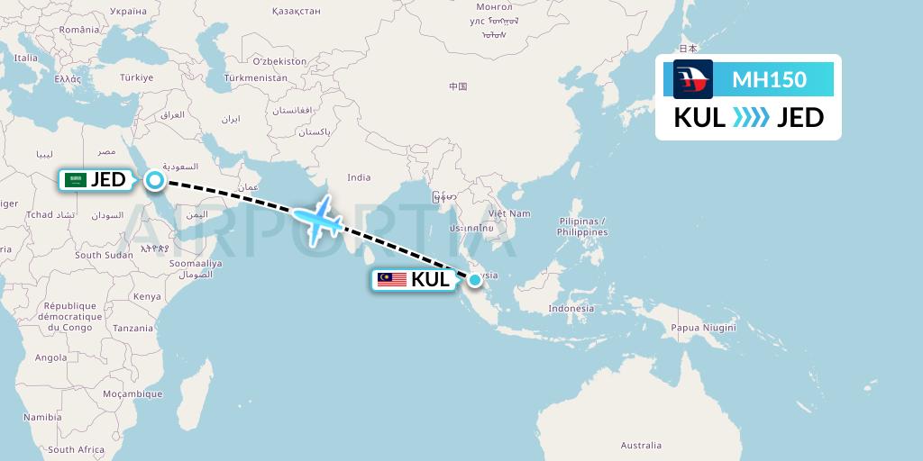
The initial search focused on its flight track from Kuala Lumpur to Beijing over the South China Sea. However the search then moved west as evidence mounted that the plane had turned towards the Malaysian Peninsular after its ACARS and transponders were turned off.
Within a week it was formerly revealed that the plane had flown on for seven hours based on satellite tracking and had turned south into the South Indian Ocean.
Inmarsat, the UK satellite company, had continued to receive responses from the aircraft to hourly status requests.
The final status request and aircraft acknowledgement occurred at 08:10 (Australian Western Standard Time) and then the 777 sent a log-on request at 08:19:29 which was followed, after a response from the ground station, by a ‘log-on acknowledgement’ message at 08:19:37.
The aircraft did not respond to a status request from Inmarsat at 09:15.
Those signals were picked up from its satellite 38,000km above the Indian Ocean and were relayed via a ground station in Perth, Western Australia.
On March 16 the search was moved to the Southern Indian Ocean with the first aerial searches being conducted from Perth on March 18 – 10 days after the MH370 disappeared.
Oceanographers agreed that any chance of spotting a major debris field was lost.
The search area moved several times as new data indicated the aircraft may be further north.
With the disappearance came a flood of conspiracy theories. According to a former 777 Check Captain, only human input could be involved.
Speaking exclusively with AirlineRatings.com the check captain said given the facts we know, that MH370 ended its flight in the southern Indian Ocean, “human input was essential.”
“We are not dealing with an out of control plane. It is impossible for the Boeing 777 to fly this course by itself,” said the check captain.
“It required a pilot or someone with knowledge of the 777 flight systems.”
MH370 made three course changes and at least two altitude changes according to the Malaysian military.
After the initial search areas came up with no results the Australian Transport Safety Bureau (ATSB) which had been charged with leading the search convened a think tank of the best minds in the business to rethink the disappearance.
The ATSB said that “refinements to the analysis of both the flight and satellite data have been continuous since the loss of MH370.”
There were five independent groups formed and all came up with the same search area.
Backing up the shift in search much further south, the ATSB issued a comprehensive 64-page report detailing its analysis.
The first stage of the new search initially involved the mapping of 60,000sq/km and eventually over 200,000sq km of the ocean floor. That mapping was essential before the deep sea towed side scan sonar operation was undertaken. The sea bad in the area is up to 6000m deep.
The ATSB dismissed some reports that there was disagreement among the expert teams that are calculating the search area for MH370. ATSB chief commissioner, Martin Dolan, said that there were two priority search areas for MH370 because the five teams had been using differing methodologies to calculate the likely flight paths of the aircraft based on satellite communications data.
The five teams were: Inmarsat from the UK, Boeing, Thales Group from France, the US investigator the National Transportation Safety Board, and the Australian Defence Science and Technology Organisation.
All teams agree the final resting place of the Boeing 777 is near to what is called the 7th arc which is a curve that stretches from about 1000km off Exmouth to a point about 2000km south-west of Perth.
Three ships were initially involved in the search, the Go Phoenix, Fugro Discovery and Fugro Equator and they were joined by a fourth in early January 2015.
More: Vanished plane not without precedent.
More: MH370 We will find it.


